The Halemau’u Trail traverses the northern side of the Haleakalā crafter rift zone, connecting trailheads along the Western rim of the crater to backcountry campgrounds like Holua and Palikū. A portion of Halemau’u Trail is frequently combined with a portion of the Keonehe’ehe’e (Sliding Sands) Trail to create an epic 11 mile (17.8 km) point-to-point day-hike. We hiked the entirety of the trail as part of a multi-night backpacking itinerary in November 2023.
The section describes the Halemau’u Trail route from Palikū campground to Holua campground within the crater interior.
Table of Contents
Planning your own trip to Haleakalā? Check out our Guide to Backpacking inside Haleakalā National Park
Watching Sunrise from inside Haleakalā Volcano
Due to its high elevation and relatively isolation in the middle of the Pacific Ocean, Haleakalā National Park has some of the best stargazing on the planet. Our first night at Palikū, the rainclouds obscured any possible view. The second night was clear, but the moon was nearly full, illuminating the entire valley as well as the sky. There’s no cell phone reception anywhere within the crater, so I looked up the time of moonset and sunrise prior to the the hike in. On this night, there would be about two hours of dark sky.
When the alarm goes off, we crawl out of the tent to a clear view of the Milky Way and countless glittering dots of light. There are so many stars that it almost becomes difficult to make out the familiar constellations. We witness a few shooting stars.
With just a few hours before sunrise, we decide to break camp in the dark and attempt to watch the sun peak over the horizon from further inside the crater valley.
Click on galleried photos to enlarge and view as a full-screen slideshow.


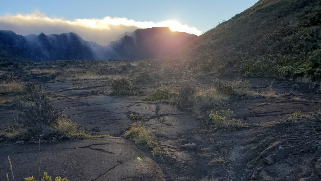
Close to ‘Ō’ilipu’u, the trail crosses several patches of pahoehoe lava, a smooth, wavy lava that forms from thinner, more fluid molten basalt. It is often described as having a twisted rope like surface; I thought it looked a bit like asphalt poured along the ground.
We knew that the trailside field of pāhoehoe lava would be the perfect place to watch the sunrise and eat our breakfast. Stepping off trail can not only damage the delicate ecosystem, but can also lead to lasting footprints that encourage others to follow. This would be a spot we could stop to rest while taking care to minimize any unintended impact.

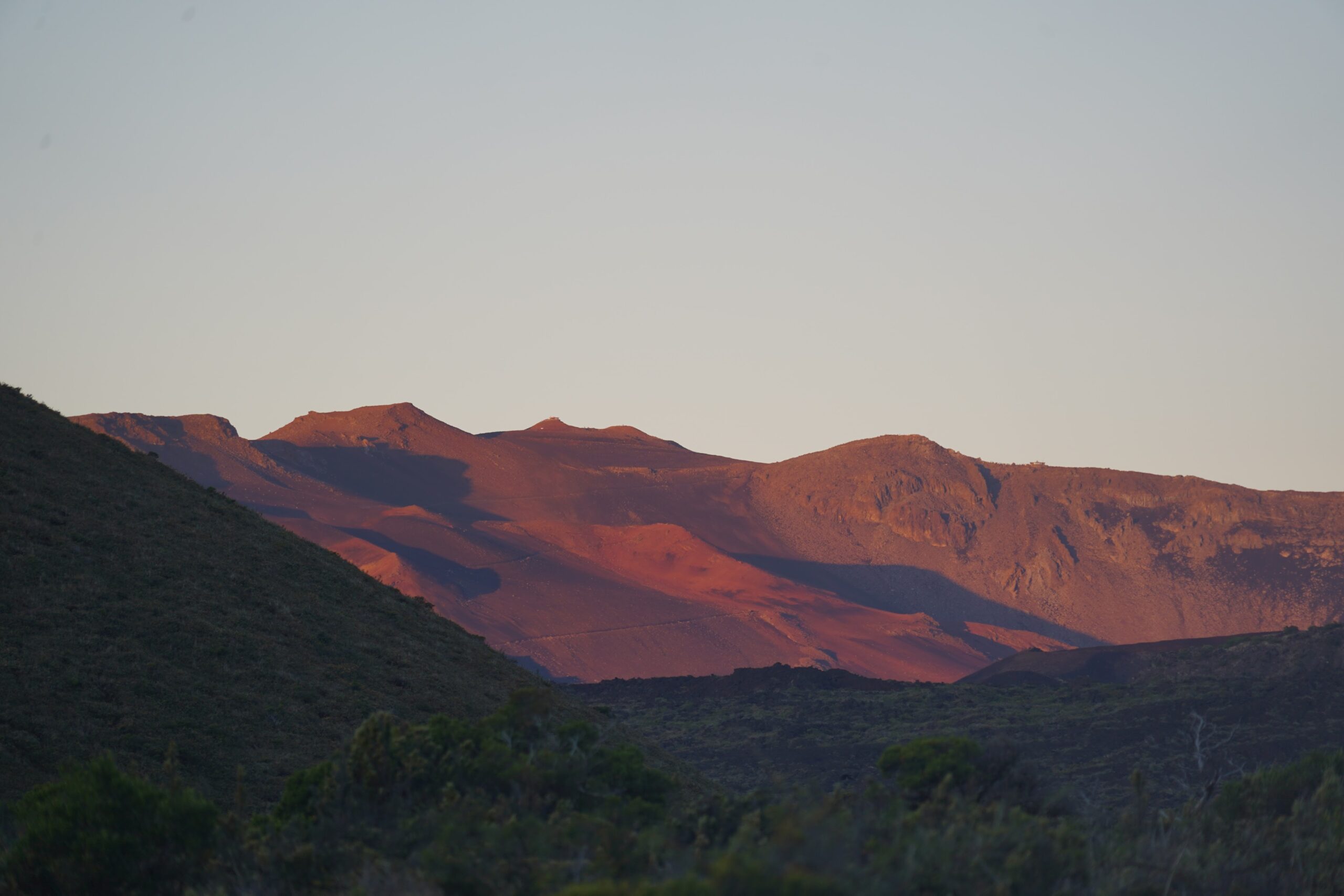
In the dark, across the crater valley, we could barely make out the headlights of cars driving up to the summit from the visitor center, providing a sense of scale for the entire area. The sunrise was a different, but no less mesmerizing, experience from the one on the summit. Here, it was less about the spectacular moment was not the burst of sun over the horizon, but rather the slow progression of alpenglow on the far rims of the crater and on the summit itself.
Looking back towards Palikū, the mists tumbled over the western wall of Kaupo Gap as the sky began to lighten. Looking down Kaupo Gap, you could even make out the peaks of Mauna Kea on the Big Island of Hawaii.
It was an peaceful, inspiring way to start the hike across the crater valley floor towards Holua.

Lava, Pu’us and Volcanic Cones of Halemau’u Trail
The distance between Palikū and Holua is only 6 miles, making for a leisurely day of hiking. The first several miles were consistently uphill at a steady grade, with the trail a combination of black volcanic sands and lava rocks. Pu’u Maile stood out prominently across the valley.

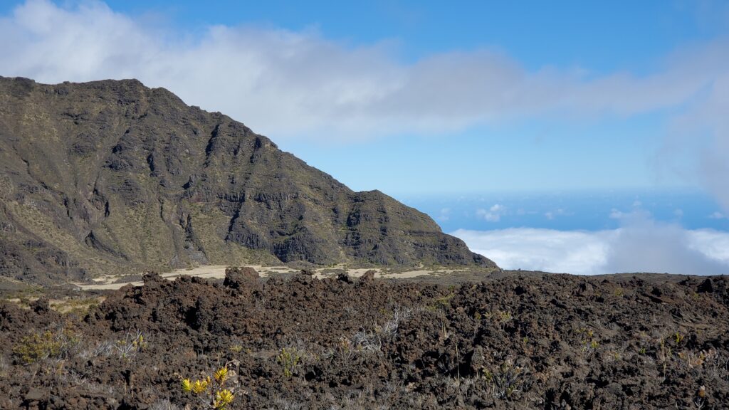
We crossed multiple fields of ‘A’ā lava flow, full of rough, jagged rock. Unlike the smooth spread of pāhoehoe lava, ‘A’ā lava slowly tumbles over itself, forming “clinkers.” I find it noteworthy that it is the native Hawaiian terms for the different lava formations – pāhoehoe and ‘Ā’a – that have become the technical English geologic terms.


One of the most enjoyable aspects about the entire backpacking circuit throughout Haleakalā volcano is that it provides both up close and vista views of the volcanic geology. After hiking directly through this lava flow between Kapalaoa cabin to Palikū a few days prior, this section of the Halemau’u trail gave us a wide angle perspective of the lava around Kaupo Gap.
Geologists have identified the youngest lava flow within this area occurring approximately 1000 years ago.

As we continued hiking up, the shrubs disappeared and were gradually replaced with chunks of ‘A’ā. Up on the hills, tall dikes of rock shot up vertically like spines along the back of a Stegosaurus. If it weren’t for the remnants of the lava rock walls and terraces it would have been easy to imagine walking across an uninhabited alien planet.

Shade had been almost non-existent on the trail, making the shadows behind Pu’u Nole all that more enticing as a resting spot. There were several large rocks by the trail on which to sit and dump out the sand that had accumulated in our shoes.


The density of pu’us became noticeably higher from this point forward. There are a total of fourteen named pu’us and cones mapped on the valley, and we had already ventured close by half of them. There is also a network of other trails across the crater valley floor connecting back to the Keonehe’ehe’e (Sliding Sands) trail that pass between a few other pu’us, but the Halemau’u Trail itself provided the most rewarding views.


One of the most unexpectedly scenic spots was Pele’s Paint Point. The trail weaves through the Halali’i cinder cone and the sands are bright with the colors of red, ocher and white each derived from a different concentration of minerals.


Once through Pele’s Paint Pot, we left Kalapawili Ridge behind and ventured into Ko’olau Gap, the second major erosional valley in Halakalā. This is also where the trail connects back up with the Keonehe’ehe’e (Sliding Sands) – Halemau’u Loop day-hike. We hadn’t encountered a single other hiker since leaving camp, so it felt a bit jarring seeing other people on the trail!
Hiking into Holua across the Ko’olau Gap

The trail between the intersection and Holua was mostly downhill, but the distances are deceptive. When you can see the trail stretch out before you, everything feels close and yet seems to take longer than it should to reach a waypoint. I thoroughly loved this section of the trail. Walking through an empty, rocky barren landscape felt otherworldly, like walking across the surface of Mars.
The soft sands continued for about a mile before the landscape shifted once again, back to the red dirt of the alpine cinder desert and shrubland from earlier in the day. Shortly after the shift, the trail splits, offering an alternate route through a Silversword Loop.
Eager to get to camp, we initially opted to stick to the main path thinking it would have added on extra mileage (it wouldn’t have; they’re actually the same length). FOMO is real, though, so we returned later in the afternoon after setting up camp to check it out.


If you were hiking down from Halemau’u Trailhead, this would be the closest place to see the endemic, endangered silverswords but there did seem to be fewer in the eponymous detour than in the stands we encountered along the Keonehe’ehe’e (Sliding Sands) Trail. Many of the silverswords in this area have been carefully encircled with rocks by park volunteers to deter wayward feet and guard against damage.


The final stretch across Ko’olau Gap traverses another relatively young lava flow, approximately 900 years old, which emanated from the Ka Lu’u o oka ‘O’o, the prominent cinder cone visible from the summit. Here you can see a number of pioneer lichens, one the first to grow on the basalt lava rocks due to their ability to obtain nutrients by breaking down bare rock.
Over time, they build up soils, retain moisture and start to create suitable habitats for other species to grow, like the ferns which sprout up from depressions in the piles of lava rock.

Camping at Holua Campground inside Haleakala
Holua, both the cabin and campsite, are tucked up against the cliffs of Leleiwi Pali. Somewhere obscured in the clouds is the Leleiwi Overlook, providing views of the expanse over which we’d just crossed. It can be accessed via a short walk directly from Haleakala Hwy.


We arrived into Holua around noon, leaving plenty of time to set up camp, explore, and relax in preparation for the hike out tomorrow. The Holua campground is located another tenth of a mile further than the cabin, up a short, relatively steep section of trail. It has its own outhouse and cistern, adjacent to the ranger outpost.

Rangers had warned that the cistern at Holua was dry, but the rains that had blown through in the few days preceding our arrival meant there was enough water on site to refill our water bladders. Had the cistern not been replenished, we would have had to hike in all the water we’d need from for the evening as well as the hike out tomorrow from Paliku, where the water source is more reliable. In times of severe drought, all cisterns within the crater can dry up — carrying in that extra water would have made for some very heavy packs!
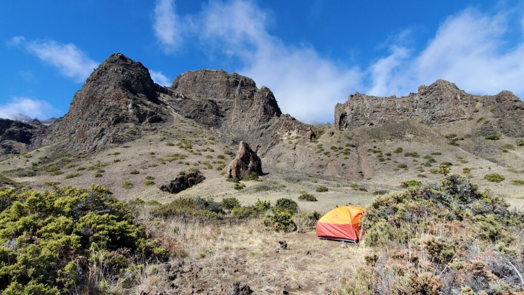
We were once again greeted by pairs of nēnē, native Hawaiian geese, as we settled into our campsite. Their distinctive calls had became a familiar soundtrack for the entire trip. Site #3 was large and flat, with hard-packed dirt and views of both Hanakauhi Peak in one direction and the towering cliffs of Leleiwi in the other. The only downside to this particular site appeared to be that you had to practically brush up against the tent in order to get to Site #4. It was also located relatively close to the group campsite which was a large grassy flat at the base of the cliffs. As it was, neither of those sites were occupied while we were there. Sites #1 and 2 both appeared to have more privacy.

We spent the afternoon lounging, filtering water in preparation for tomorrow, and exploring the aforementioned Silversword loop. Dinner was a serving of our Thai coconut chicken and rice backpacking recipe. Tomorrow would we break camp and hike up the switchbacks to the trailhead, before continuing onto the tropical Kīpahulu District via the Road to Hana.
Read More Backpacking Trip Reports from Haleakala National Park
- Day 1: Palikū Campground via the Keonehe’ehe’e (Sliding Sands)
- Day 2: Exploring Palikū and Kaupo Gap
- Day 3: Halemau’u Trail from Palikū to Holua – that’s this trip report!
- Day 4: Hiking the Halemau’u Switchbacks
Planning a Backpacking Trip to Holua via Halemau’u Trail
Camping overnight at Holua requires advanced permit reservations from the Rec.gov. Permits are for a numbered campsite. There was a map on site of the general campground layout as well as brown stakes indicating the location of each campsite.
How do I get to Holua Campground?
There are three ways to get directly to Holua Campground: hike the 7.4 miles from Haleakalā Summit Visitor Center via Keonehe’ehe’e (Sliding Sands) – Halemau’u Loop, hike 3.7 miles down the Halemau’u Switchbacks, or hike 6 miles from Palikū campground as part of a multi-night hike. If time allows, we recommend hiking in via either Keonehe’ehe’e (Sliding Sands) or from Palikū, and hiking out via the switchbacks.
What to Pack for Hiking the Halemau’u Trail to Holua
As with any hike within the Haleakalā crater, the two most important considerations to keep in mind are water and altitude. The Halemau’u Trail is relatively mild in terms of both elevation gain/loss as well as distance, but unreliable water within the volcanic crater itself – both at Palikū and Holua – as well as an average elevation of around 7000 ft (2100m) can easily pose a challenge under the right circumstances.
In addition to the ten essentials, we recommend:
- Extra water bladder. In the days leading up to our hike, the cistern at Holua could not be depended on for water. While it ended up being replenished during our trip, having a 4L water bladder on hand gave me the assurance that we would have enough water to complete the hike without becoming parched at the high elevation.
- Sand gaiters. The black lava sand found along portions of Halemau’u trail is sharp. A pair of running gaiters or sand gaiters would have prevented a lot of unnecessary suffering trying to get these jagged little devils out of our socks. Your feet will thank you.
- Light weight rain jacket or windbreaker. In the span of a day, the weather went from hot and dry, to some. Having a rain resistant/wind jacket will give you extra warmth if the weather turns unexpectedly foul while you’re in the middle of the crater.
- Sunscreen. UV rays are stronger at higher altitudes because the atmosphere is thinner. Carry enough to reapply throughout the trip.
- A map of the trail. The Halemau’u Trail is well traveled and easy to identify from the surroundings. Getting lost is unlikely. However there are so many unique features along the trail that a map indicating names, locations and even a bit of geology will help you appreciate the special Hawaiian landscape you’re hiking through all that much more.
Have questions about backpacking to Holua or hiking the Halemau’u Trail in Haleakalā National Park? We’re happy to answer in the comments below.


